Tsingy de Bemaraha: Madagascar's forest of stone needles
The name means the place where one cannot walk barefoot. UNESCO listed the limestone reserve in 1990 for its geography, mangroves, birds and lemurs.
Lire cet article en français →
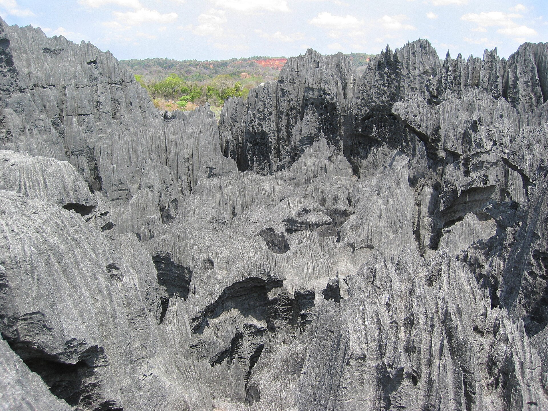
Antsalova — Near the western coast of Madagascar, in the Melaky region, the land rises into needles of limestone so sharp they can cut through equipment and flesh. The word tsingy comes from a local word for "the place where one cannot walk barefoot".
A landscape that protects itself
The formations stand above cliffs over the Manambolo River, and they make crossing the area extremely difficult. UNESCO listed the site as a World Heritage Site in 1990 for its unique geography, its preserved mangrove forests and its populations of wild birds and lemurs.
The southern end of the protected area became Tsingy de Bemaraha National Park in 1997. The northern end remains a strict nature reserve. The borders were adjusted in 2011.
Getting there
Visitors can reach the park by road from Morondava, about 150 kilometres to the south. Limited access is also possible from the town of Antsalova, which can be reached by plane from Antananarivo or Mahajanga.
Background: Wikipedia.